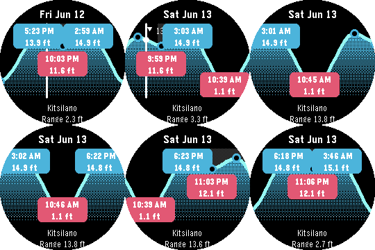
Pebble Tides shows the day's tides at a glance: a graph of the high and low tides with their exact times and heights, the current water level, whether the tide is rising or falling, and optional mid-tide times. It uses your location to pick the nearest tide station and keeps working offline by caching a week of predictions, or pin a region ahead of a trip to cache up to 45 days across a whole area.

Features:
- Uses your location to pick the nearest tide station
- Daily tide graph with high/low times and heights
- Current level with a rising/falling indicator
- Optional mid-tide times (off by default)
- Sunrise and sunset night shading
- Step through tides with the buttons; long-press to jump a day, Select to jump to now
- Feet or metres, 12 or 24 hour clock, all set from the phone
- Caches a week of predictions and refreshes once a day; works with the phone out of range
- Pin a region for an upcoming trip: download up to 45 days for every station within a chosen radius, then see the nearest one offline as you move

Coverage: Pebble Tides covers
- Canada (Fisheries and Oceans Canada, DFO)
- United States (NOAA)
- Australia and the South Pacific (Bureau of Meteorology, BOM)
- United Kingdom, Ireland and the Channel Islands (UK Hydrographic Office, EasyTide)

It picks the station nearest you, or the nearest station inside a region you pin for an upcoming trip. If you'd like another region added, let me know and I'm happy to look at adding it.

Controls: Up/Down step tides, long-press Up/Down jump a day, Select jumps to now, Back exits.